ABOUT US
We have been diving professionally and instructing dive courses. for more than 20 years. So far, we have dived like several thousands of times and trained lots of divers of various grades. We built this site to share our experiences, make new acquintances and guideand train your scuba diving facilities.
Starting with quesitons like ‘What is scuba diving?’ and ‘How to become a scuba diver?’, we built library pages also including issues concerning upper grade divers.
Knowledge grows when shared. According to this principle, we shared the basic course notes. Our goal is to enrich the content of these pages. We look forward to your contributions.
We have prepared pages showing and introducing the dive sites of Saros Bay, which is our main diving area . We prepared a gallery of photographs taken by our underwater photographer friends here. We did dives in many parts of our country and abroad. We will also share photos taken by our own or underwater photographer friends from these regions.
If you want to become acquainted with underwater world and get dive training or dive, our contact information is on our website. You can also reach us by various social media devices. Please feel free to come in contact anyway. Take care of yourselves!
INSTRUCTORS
ENGİN GÜRFİLİZ
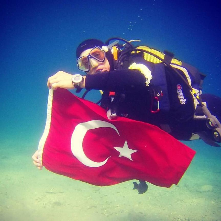 |
Kırklareli - 1968. Graduate of Marmara University, Faculty of Technical Education, Department of Electrical and Electronics Engineering. Completed his master's degree at Trakya University, Institute of Science. Scuba diving since 1998.
|
EYLEM GÜREL |
|
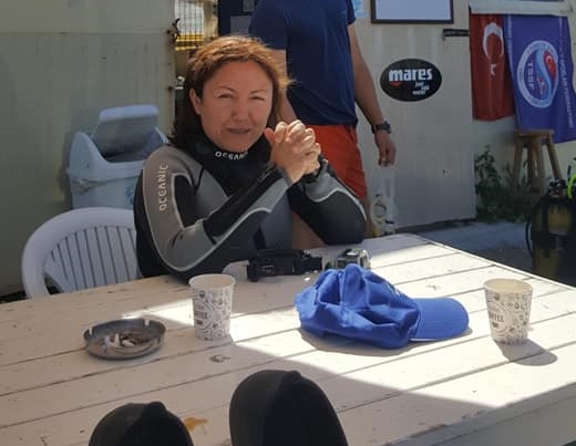 |
Edirne 1974. Graduated from Food Engineerind Department of Ege University. Completed her master's degree in Agricultural Economics at Namık Kemal University. Scuba diving since 1999. Has Two Stars Instructor Badge of Turkey Underwater Sports Federation, Professional diver certificate of Ministry of Transport and Maritime, and Amateur Sailor certificate. Engaged in outdoor sports such as cycling and hiking. Animal lover and environmentalist. |
SAROS GULF DIVING POINTS
Saros Bay, due to its underwater treasures, draws lots of divers from all over Turkey.
Due to abundance of water currents, Saros' waters provide a clear and continuous view. Underwater canals also keep the bay clean.
The areas where the underwater beauties are most dense and suitable for diving are located around Mecidiye and Erikli coastal which are settlements on the borders of Keşan district.

İbrice Port. Paradise and Hell Bays.
Port of İbrice is a fishing port located 4.5 km away from Mecidiye, Keşan. İbrice is the most preferred place for diving on Saros gulf There are many diving spots around the İbrice port and on the offshore cliffs. Dive clubs organize training dives in this region. You can swim from the shore of the port for diving. On the other hand, the most popular places are the dive spots called Paradise and Hell, located on both sides of the port.
Hell (3-40m) is a bay that is reached by a steep downhill on the left side of the port It takes its name due this steep wiev.. In this bay, dive training and normal dives are done. In the cavities, which are drifting into the sea, there are eels, mangrues, insects and lobsters. Coral formations are observable.
The dive point to the right of the port is the dive point known as paradise. It runs parallel to the port rocks and can be deepened up to 8-10 meters. This is one of the preferred places for night diving.
Cape of Toplar – Tunnel
This rock wall between Erikli and İbrice takes its name from the historical cannonballs, which seem to be abundant around. Cape. is located 500-600m away from the port. . Next to the cape, you will meet the shores of Incekum (popularly known as denizara bay) and Uzunkum beaches. This cape is also known as Ibrikbaba cape among fishermen.
Cape of Toplar is very suitable for wall diving. Divers are usually transported to this area by boat and enter the water from the boat. Some popular dive sites are Tunnel and Kiremitlik.
For deep divers it is possible to see the fascinating beauties of rock formations at the bottom. There are many sponges and corals at this area. You can see many crayfishes in caverns. Another important site where you will see the submarine creatures of Saros all together is a natural aquarium known as Tunnel, just a little further from the Toplar cape.
It is possible to see all the submarine life of Saros in this region. Congereels, crayfish, squids and eels can give you amazing experiences. It is possible to encounter large corals and giant tuna. There are many sponge and coral covered caves in this area. These tunnels pass the Toplar cape 15 meters perpendicular to the end, approximately 3 meters deep. It is a very popular area for divers. It is also known for its turquoise colored clear water.
GÖBEKTAŞI - HEATING STONE
Another dive point, which is very close to the cape of Toplar, next to Tunnel area, is Göbektaşı locality which takes this name from its shape. There is a section of these rocks known as caves at a depth of 25 meters, which is intriguing for divers. The variety of sea creatures in the cavities of the rocks in this cave is also fascinating.
MİNARE
This is a diving point where you will come across from the Toplar Cape, before heading to the Kiremitlik dive point on your way to Hebrew. The location is quite ideal for deep diving. In the middle of the sea, a rock column rising from the bottom of the sea is named after this. It is a diving point that must be tested for experience.
KİREMİTLİK
Kiremitlik is a beautiful diving spot between the Cape of Toplar and the İbrice port area. It starts with a sandy area and goes rocky at 25m. While watching these cliffs from the sea, you will be surrounded by a clean turquoise sea. For submarine life, caverns on the cliffs contain treasures. It has 4 separate trails. It is a natural reef zone and has a balcony wall structure. It is a unique region both in terms of vitality and wall structure.
DERİNDERE (18-22 M)
Artificial Reef region. There are 200 artificial reef blocks in the region. As a result of the artificial reef construction, the region has gained the appearance of an aquarium since September 2010.
ÇAPA BANKO (9-25 M)
The region is a reef region with a very old and very large anchor and 5 different anchors in different sizes. Bottom structure is a rich region. This is also the Artificial Reef region.
DOVE'S CAVE (6-28 mt)
It is in the Kiremitlik area. It is the fourth diving course of the region. It is a type of cave with a large entrance at 28 meters. There are lots of crayfish at the entrance of the cave. The area is intertwined with the dive site, also known as the Minaret.
ASKER KAYASI - MILITARY STONE
Asker kayası is a diving point in Uzunkum region. You can reach it 150-200m away from the Toplar cape, when you pass the cape, there is Incekum beach (Denizara) stuck between the hills before the cape, and on the hill just behind it, Uzunkum beach welcomes you with a length of up to 1600 meters.
Asker kayası is located almost 1 mile offshore. It is a reef that starts at a depth of 12 meters, descends to a depth of 33 meters and is around 250 meters in diameter. This is a very rich reef. Although it is a favorite point of professional divers, it should be said that it is more open to currents.
Particularly large lobsters are found here. It is a rich reef that will allow sea rabbits to reproduce.. It is said that Saroz, which had been a military zone for many years, took this name because it was a region where shots were made in military exercises.
HARMANKAYA
Harmankaya is a region that has not been evaluated much due to its distance from the İbrice port. This rocky area, starts at 7 meters to a depth of 33 meters reaching the sand floor. Located approximately 1 mile off the west coast of the village of Erikli, this reef formation is ideal for boat diving. In recent years, especially in İbrice, it has become a popular destination for those who want to prefer a quieter region and move away from the increasing diver population.
THREE ISLANDS
At the point where the Koru Mountains reach the sea, there are 3 small islets located opposite the shores of Adilhan and Sazlıdere villages. It can be reached by boat. Largest of these islands, Hedef Island, a zone used for shooting in military exercises was banned for a long time. There is no settlement on these islands. You can find small vacations on the destination island. It is possible to find suitable places for diving training around shallow cliffs around the islands connected from the bottom. Nevertheless, the region is not much evaluated.
DESPOT KAYALIKLARI
Despot cliffs are a dive site that has recently attracted divers' attention. Located on the shores of the Gallipoli peninsula, these rocks can be reached by diving boats departing from Güneyli village. From the south, many bays such as Fatma Kadın Bay, Mahmutpaşa Pier, Mavi Saros Bay and Emel Sayın Bay welcome you to the Despot cliffs along the cliffs of Saroz. The despot cliffs are also frequented by the dive boats departing from the İbrice port on the northern coast of Saroz due to its proximity to the dive point of the island of Minnos. With its coastal structure in Falezli, it is a region in which you will observe the existence of submarines and needs divers to investigate.
UNDERWATER HISTORY MUSEUM ITALIAN BAY / UZUNKUM (6-24 M)
Artificial Reef region. There are 400 artificial reef blocks in the region. Since September 2010, the area has become an aquarium. In 2012, an Open Museum application, which depicts Çanakkale Wars ", was applied to the region. Within the scope of the museum, three German artillery used by Seyit Onbaş during the Çanakkale battles were downloaded to this region in 2010. There are 2 Turkish soldiers on the side of the cannons. In June 2012, 12 Turkish and Anzac soldier statues measuring 2.20 m were reduced. Since October 2011, there have been hundreds of Subbian eggs in blocks and soldiers' statues.
MINNOŞ ISLAND AND MINNOŞ Reefs
The island of Minnos is about 10 miles from the Southern port.
It is located on the borders of Fındıklı village of Gallipoli. However, it is more preferable to go by boat from the South as it is easier to reach by sea. On the other hand, since it is an important dive point, diving schools from İbrice come to the region with boat tours.
The island of Minnoş is a reef with a depth of 7 meters after the shore. The island of Minnoş has a height of 15 meters above sea level. On the island of Minnoş, which reaches the bottom line with its very deep wall structure, diving instructors advise against diving after 40 meters. You can walk around the island for a full tour.
This region is home to a rich marine life. Especially from the points where the rocks reach the sea, hard, orange coral formations stand out. The reefs connecting the island to the shore reach from 7 meters deep to 30 meters deep sand ground. Sarpa fish, sea rabbits, insects and many other marine species can be seen.
KÖMÜR BAY
Kömür bay is one of the dive spots that have been visited by diving enthusiasts frequently in recent years. For land transportation, you should follow the road signs on the turn of Fındıklı village of Gallipoli. Boats departing from the southern port are definitely stopping at the Kömür port. In the bay, which is located between the high and right hills, divers take the rocks that descend deep inside the sea. With its turquoise waters, it is one of the most popular diving areas of Saros in recent years.
KÜÇÜK AND BÜYÜK KEMİKLİ CAPE - LARGE AND SMALL BONE CAPE
You will pass through the bays between the steep, cliffy coastal structures that descend into the sea from time to time such as Kemikli bay, Sazlı, Karaağaç bay, İncirli bay, Koyunyeri port and Ece bay, which are assumed to end from the coal sheep on the Gallipoli peninsula. Especially around İncirli Bay, there are coastal formations and cliffs in need of exploration by divers. The cliffs in this area are named as Baby Rocks by fishermen and they are especially rich in underwater existence. However, due to transportation difficulties, this area has not been used much for diving. Baby reefs, reef, wall and current dives and underwater wealth is a region recently included in the dive program.
In contrast, Ece has a more comfortable transportation by the land. The rocky coastline, which continues right next to the bay, is one of the most important places where undersea life can be traced. New campers are becoming more and more popular with divers.
You can dive around the islet connected to the shore with a coastal depression at a depth of two meters 20-30 meters from the sea in Büyük Kemikli bay.
Between the Büyük and Küçük Kemikli capes lies like a bow Suvla bay. This bay, which is also home to a beautiful sandy beach, is one of the coves where the British and Anzac soldiers took off during the Çanakale Wars. With its proximity to Big and Small Anafartalar, it has a view that visitors cannot get enough of watching the view of the income-passing visitors.
When the Küçük Kemikli cape turns, the Gulf of Saros is now open to the open waters of the Aegean Sea.
LUNDY Wreck (Suvla Bay)
Lundy was a trawler built in England in 1908. With the start of World War I, he was given the command of the British Navy to the shores of Dardanelles with mines. On August 16, 1915, there are views that the ship was sunk in the Suvla bay, as the British was sunk by the ship because it was seen among items that could have hit a mine or could not return the ship to the enemy. Considering that this region is one of the extraction sites, it is likely that it was sunk with mines.
The wreck was discovered in 1987 by fishermen. The Lundy shipwreck is the most robust and one-piece dive site in the area. Lundy stands at a depth of 28 meters on a completely sandy ground and almost as flat as it swims over the sea. It is intact except for a crush which confirms that the wreck on the stern may have hit something. On the surface of the shipwreck, many sea creatures have formed their own habitats on the surface of their warehouses, which are entered from the sections opened with the effect of choreography. Blue, purple and orange sponges, anemones, sea rabbits, small crabs, lobsters with big arms, small breames, where you can hide themselves, you will find the fishes that need to be approached carefully.
The Lundy shipwreck, which is very important for wreck diving, is also one of the most popular dive sites for underwater photographers.
WATER TREATMENT SHIP (Suvla Bay)
During the Gallipoli Wars, the wreck of the ship used to treat water to the British is also known by this name. Refinement wreck. It is located in the Suvla Bay, near the shore and in a sheltered position. In this sheltered aspect, it is evaluated by divers who see their dive more trouble, and is considered among the second dive point or places to dive in bad weather. There are also the Lundy wreck to dive in and the Anzac and English flikas.
The treatment wreck is suitable for all levels of divers. It is a wreck that can be protected in general terms. It can be seen at a depth of 14 meters above sea level with 3 boilers and coils used to treat sea water.
MILITARY LANDING FRIGATES
The Suvla Bay and beyond Arıburnu is also home to the shipwrecks of various lengths of flikas used to land the British and Anzacs. Some of these wrecks can be seen at 3-4 meters with sand stuck to the surface. On the other hand, two of the larger landing frigates are observed at a depth of 14 and 27 meters in the north-west of Suvla Bay.
GERMAN TORPIDO SHIP
During World War I, the British battleships Inflexible and Irresistible were on the shores of the Dardanelles, and the Ottoman commander of the Germans, who were allies of the Ottomans, was located in the castle of Çimenlik. One of the bombs dropped near the German command center. The soldiers were urgently evacuated from the sheds and boarded on the torpedo ship, which was anchored to the shore. However, on March 18, 1915, one of the bullets of the Irresistible was the end of the German ship. The ship, where 1315 soldiers died, is located just outside the Çanakkale marina. The wreck at 16 meters is located in the middle of the heavy traffic of the Dardanelles.
CAPTAIN FRANCO Wreck
Captain Franco: Franco is a Greek-flagged cargo ship carrying asphalt raw materials. A Romanian cargo ship effectively slams the starboard head to the side, creating a large tear in the hair hull. Although the captain steers himself to the beach, the journey ends at a depth of 40 meters. When viewed from the surface, the coast is very close, but suddenly the deepening of the strait barely accommodates the shipwreck at a depth of 40 meters. The ship lies lying on the pier side. The raw material blocks in the warehouses are spread over the floor. The shipwreck stands intact with its poles, prop and rudder. What is interesting is the colorful soft corals in the secluded parts of the wreck. These corals proliferate markedly over the years. The second disadvantage of day 2 Franco dives is that the bottom current is quite a lot of depth, but the other disadvantage is the sudden currents. Since the ship is quite long, most of the wreck is not easily navigable because of the current. Especially because the starboard side remains on top, the current is rapidly dragging the divers to the other side. Taking into account the depth, such diving requires both experience and at least an ADVANCED badge. The most seamless wreck in terms of viewing angle, current and depth. Pools in the area, lies between 27-43 meters.
MAGESTIC Wreck
Majestik was built in 1895 and was the oldest communication vessel of the British. While the Dardanelles attack was being planned, Churchill claimed that this ship was old, but other ranks who defended that it would easily take over Dardanelles and easily seize Istanbul had taken Majestik to the sea fleet. There is a special enthusiasm for diving in this ship, which is included in the 18 March sea decals. After seeing the black and white photo of the ship in the museum, your enthusiasm will increase. The shipwreck is located in Morto bay near Seddülbahir which is located at the very end point of the Dardanelles. The 1895 structure was sunk by this old British ship U-21 German submarine. The ship, which weighs 14,900 tons and has a length of 119 meters, sank with 757 crew members on the shores of the Dardanelles. As soon as it starts, the ship's silhouette appears after 15 meters. With its unexploded bombs, the swiveling ground where the cannon sits, the chimneys and the underwater fauna around the watchtower, the photographer enjoys pleasant moments. The strong current in the region may prevent you from finding the landing rope and climbing to the surface. Therefore, it is useful to set your dives without deco. Otherwise, if you wait for decompression without clinging to a place, the current will cause you to climb to the surface a few miles away.
NUSRAT TORPEDO BOAT WRECK
Originally a coast guard boat of 155 grosstons weight and 45m width was revised similar to historical Nusrat torpedo boat which carried an important role during Çanakkale wars and was sunk in 2014 off shore Mecidiye, Keşan. It lies between depths of 18-29m.
PLANE WRECK
Worlds largest aeroplane wreck has recently been sunk off shore Mecidiye, Keşan in June, 2019. It is an Airbus A330 with a net weight of 85tons and dimensions of 63.67m length, 60.3m width and 5.64m height. It lies between 19-27m.

